Louth Town Council - Working with the community to make Louth a better place to live and work
Wards
To view the key for this interactive map click the icon on the top left next to the title ‘Ward Maps Louth Town Council’. You can click on each ward to either show or hide the area. If you click on the name of the Ward on the Key, it will show who the Ward Councillors are. If you wish to see the Conservation area (approximate boundary) go to the bottom of the key and click the check box for Conservation Area. If you wish to search for a road within these areas, click on the icon on the right hand side of the title to view a larger map, and that will give the option of a search at the top of the key.
Councillors work for the betterment of Louth, its residents and businesses. They listen to local concerns and give residents a voice on the decisions the Council makes, as well as liaising with the District and County Councils.
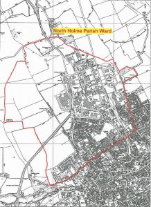
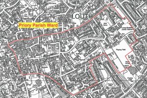
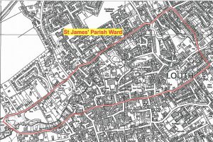
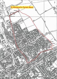
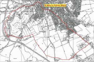
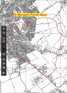
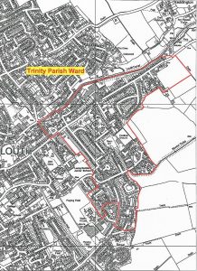
Each Councillor is dedicated to a particular area in the town, called a Ward, and there are seven Wards, each one represented by three Councillors.
Please note that these will open as PDF/A compatible documents.
North Holme ward 1832 St James’ ward – 1975 St Margaret’s ward- 1969 Priory ward – 1740 St Mary’s ward – 1863 St Michael’s ward – 1785 Trinity ward – 1714 Total for Louth town wards 12878